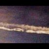
Í þessari 10 min video samantekt er fjallað um fréttir frá Sept. 11. 2001 sem að stjórnvöld (bandarísku) vildu ekki að þú sæir.
Svo gott sem allar fréttastofnanir skýrðu frá öðrum sprengingum í sömu hæð og andyri bygginganna voru.
Þú getur heyrt margar sprengingar springa í bakgrunninum í videoi þar sem New York City slökkviliðsmenn segja öllum að yfirgefa bygginguna vegna þess að það sé annarskonar búnaður/tæki í byggingunni..
Fullyrðingar frá slökkviliðsmönnum:
" hæð eftir hæð sprakk út"
"Það var eins og það væri sprengt. Eins og þeir ætluðu að fella bygginguna".
Ekki horfa á þetta video ef þú trúir enn skýringum stjórnvalda.
En ef þú horfir á þetta video þá neyðist þú til að spyrja þig hversvegna hafa þessar upplýsingar verið þaggaðar niður af yfirmönnum fjölmiðla og stjórnvalda?
Auðvitað búið að eyða þessu video - þegar ég skoða núna 26 Januar 2016
This 10 minute video compilation covers the news from September 11th, 2001 the government does not want you to see.
Virtually every news agency reported secondary explosions in the buildings at the lobby level. You can hear multiple “bomb” blasts in the background of live video as New York City firemen tell everyone to clear the area because of “secondary devices” in the buildings.
Statements made by New Your firefighters:
“floor by floor starting popping out”
“It was if it was detonated. Like they were planning on taking down a building.”
Don’t watch this video if you wish to believe the official government story. If you do watch the video you must ask why has this information been suppressed by officials in media and government?
This is the Official Review of the UFO appeared in Montevideo, Uruguay. OCtober 22.
Sá sem tók videoið er ekkert smá hræddur.. en svolítið skrítið að sjá á videoinu að það er eins og sumir taki alls ekki eftir því....bara sumir ..það sést nokkuð vel þarna á videoinu.. Það er skýjað og rigning þegar videoið er tekið.. En er þetta "hologram"?
Útlínur þessa undarlega hluts hurfu og birtust á víxl og breyttum um lögun og útlit en samt kyrrt á sama stað.... Svo í lokin á videoinu þá allt í einu sendir þessi hlutur útfrá sér þvílíka birtuna að það sést ekki í húsin og götuna nema rétt í jöðrunum..Svo sést hluturinn ekki meir..
Hverjir eru að fylgjast með okkur á þessari jarðarkúlu?
Það hefur verið rosalega mikið um að fólk sé að sjá alskyns undarlega hluti, ljósfyrirbæri upp á síðkastið út um allan heim..
Reyndar mjög mikið allt þetta ár....
Kanski þetta sé "liðið" sem stjórnar fjármálakreppunni um allan heim...hehehehe..ja blame it on sombody....just not me....( kanski ljótt jók..en hjá "sumum" virðist banka kreppan hér á landi vera voða fyndin...) Set hér inn slóðir fyrir UFO áhugafólk...og þá sem annað slagið líta upp fyrir tærnar á sér og þramma ekki bara götuna blindum augum á eftir forystusauðnum....í hvaða forarvilpu sem er og fram af hengifluginu beint á eftir honum .......
UFO Cheshire UK 2008
October 02, 2008 An object appears to buzz close to a plane, then in the last frames speeds off at a high rate of acceleration.
In his own words Apollo 14 Astronaut Dr. Edgar Mitchell, the 6th man to walk on the moon, states that the alien flying Saucer crash at Roswell was real along with the recovery of at least four aliens bodies. This Clip is from MSNBC please visit them here: http://www.msnbc.msn.com/
::aceBryan7cox UFO DIRECTORY::
Man Abducted By UFO
Amaury Rivera phototgraphed the UFO that abducted him. The man was interviewed by various news people. October 25, 2008
The greatest proof of UFO's real abduction not fake !
en þetta video tekið með eftirlitsmyndavél er mjög svo scary...
ÞAÐ ERU Í RAUN VIÐ SEM MUNUM VERA MERKT(og erum nú þegar þó svo fæstir geri sér grein fyrir því) SEM HVER ÖNNUR DÝR "MERKURINNAR"..sem auðvelt verður að "hunt down" hvar sem er og hvenær sem er...Þannig sé ég allavega meininguna í þessari setningu ,,Mark of the beast"GPStæki eru ekki bara ætluð þér til þæginda, heldur ert þú líka trakkaður í gegnum það kvikindi..."Big brother" fylgist með þér allstaðar..t.d. gegnum gemsann meira að segja þó að sé slökkt á honum..hægt að finna þig gegnum hann...
Það eru allstaðar "tag" eða "chip" þar sem hægt er bæði að fylgast með þínum gerðum, ferðum, tali, gagnaflutningi og bara hvað þú verslar...maður getur ekki einu sinni dulist á klóinu lengur....
Today's Bible Prophecy : The Microchip
No Verichip For Me Thanks!
The world economy in 2008 to 2010, Astrology, Bible prophecy
Þetta video er sett inn December 10, 2007 og hver er svo staðan í heiminum í dag?
NORTH AMERICAN UNION & RFID Chip TRUTH! Must SEE
1-3 THE MARK OF THE BEAST 666 BIO-MICROCHIP IMPLANT
2-3 THE MARK OF THE BEAST 666 - BIO-MICROCHIP IMPLANT
3-3 THE MARK OF THE BEAST 666 BIO-MICROCHIP IMPLANT
One World Government RFID 666 part 1
One World Government RFID 666 part 2
One World Government RFID 666 part 3
Is Verichip the Mark ?
Úff..vinnuveitendur setja "mark" (markaður..eða merktur) í fólk..til að fylgjast með vinnu og ferðum þeirra...
Your cellphone is tracking your every move
Is Your Cell Phone Bugged?
The Cell Phone Towers In Disguise (CBS News)
New World Order is Here!
New World Order and the Chemtrails Connection
Scientist and researcher,Rosie Bertell continues to provide damning evidence concerning the military, goverment, scientists, giant corporations (the Illuminati) involvement in the world-wide sinister "Black Project" known as Chemtails. International collusion, aerial pharmacopoeia are explored and all point to the New World (dis)Order.
Find out which sensitive locations are off-limits online.
IT Security Editors on July 15, 2008
digg_url = 'http://digg.com/security/Blurred_Out_51_Things_You_Can_t_See_on_Google_Maps'; Depending on which feature you use, Google Maps offers a satellite view or a street-level view of tons of locations around the world. You can look up landmarks like the Pyramids of Egypt or the Great Wall of China, as well as more personal places, like your ex’s house.
But for all of the places that Google Maps allows you to see, there are plenty of places that are off-limits. Whether it’s due to government restrictions, personal-privacy lawsuits or mistakes, Google Maps has slapped a "Prohibited" sign on the following 51 places.
The White House: Google Maps' images of the White House show a digitally erased version of the roof in order to obscure the air-defense and security assets that are in place.
The U.S. Capitol: The U.S. Capitol has been fuzzy ever since Google Maps launched. Current versions of Google Maps and Google Earth show these sites uncensored, though with old pictures.
Dick Cheney's House: The Vice President's digs at Number One Observatory Circle are obscured through pixelation in Google Earth and Google Maps at the behest of the U.S. government. However, high-resolution photos and aerial surveys of the property are readily available on other Web sites.
Soesterberg Air Base, in the Netherlands: This Dutch air-force base and former F-15 base for the U.S. Air Force during the Cold War can't be seen via Google Maps.
PAVE PAWS in Cape Cod, Mass.: PAVE PAWS is the U.S. Air Force Space Command’s radar system for missile warning and space surveillance. There are two other installations besides the one in Cape Cod.
Shatt-Al-Arab Hotel in Basra, Iraq: This site was possibly censored after it was reported that terrorists who attacked the British at the hotel used aerial footage displayed by Google Earth to target their attacks.
Leeuwarden, Netherlands: This Dutch city is one of the main operating bases of the Royal Netherlands Air Force, part of NATO's Joint Command Centre and one of three Joint Sub-Regional Commands of Allied Forces Northern Europe. Leeuwarden is also one of two regional headquarters of Allied Command Europe, headed by the Supreme Allied Commander Europe.
Novi Sad: This military base in Serbia is off-limits.
Kamp van Zeist: Kamp van Zeist is a former U.S. Air Force base that was temporarily declared sovereign territory of the U.K. in 2000 in order to allow the Pan Am Flight 103 bombing trial to take place.
NATO C3 Agency: Located in Brussels, Belgium, the C3 Agency supports NATO through scientific support and funded acquisition of C4ISR (Consultation, Command, Control, Communications, Intelligence, Surveillance and Reconnaissance) capabilities.
NATO Air Base Geilenkirchen : This is the site of the main operating of NATO's Airborne Early Warning Control Force's E-3A Component, which provides an early-warning radar system to enhance NATO's air- defense capabilities. The base includes 17 E-3A aircraft used for air surveillance and air-operations-communications support. Crews from 14 nations, including Spain, Turkey and the U.S., power the aircraft.
Ramstein Air Base in Germany: Ramstein Air Base figures prominently in Operation Iraqi Freedom and Operation Enduring Freedom. It's the home of the 86th Airlift Wing and headquarters of U.S. Air Forces in Europe. It is also a NATO installation. Americans, Canadians, Germans, British, French and other nationalities comprise the base's population.
The Royal Stables in The Hague, Netherlands: A division of the Civil Household, the Royal Stables arranges transport for the members of the Royal House and the Royal Household.
Huis Ten Bosch Palace: This address is one of the four official residences of the Dutch Royal Family, also located in The Hague, Netherlands. Queen Beatrix has lived here since 1981.
Political Pushback on Google Earth and Google Maps' Street View
North Oaks, Minn.: In late June 2008, the St. Paul, Minn. suburb of North Oaks successfully petitioned that street images be removed from Google Maps’ Street View feature. The argument put forth collectively by North Oaks' 4,500 residents involves the fact that the town has private roads that are protected by a trespassing ordinance. Google spokeswoman Elaine Filadelfo said that she didn't know of any other city in the country that has made a similar request.
The Boring Home:Aaron and Christine Boring of Franklin Park Pa. claimed that Google Maps' Street View feature violated their privacy, devalued their property and caused them mental suffering by posting images of a private road in front of their house. The Borings said that the images of their home must have been taken from their long driveway, which is labeled "Private Road."
Bahrain: In August 2006, Bahrain's Ministry of Informationinstructed the country's Internet exchange to block access to Google Earth servers. The ban lasted three days. Internet rumors claimed that the ban's goal was to keep poorer citizens from viewing the elaborate residences and private jets of the country's rich, in order to keep secret the inequity of wealth distribution in Bahrain. Cyberactivists circulated an email that contained a PDF file with annotated Google Earth screenshots of the supposed Bahrain sites.
Europe: In May 2008, the EU's (European Union) data-protection agency railed against Google Maps' Street View feature, which shows ground-level, 360-degree views of streets in 30 U.S. cities. Officials claimed that the feature may break EU privacy laws if launched in Europe.
Singapore: In April 2008, the country's government claimed that the ban stemmed from a dispute between SLA (Singapore Land Authority) and Google over copyright issues. SLA alleged that the satellite images on Google Earth are direct copies of real geographic features in Singapore and infringe upon the organization's copyrights.
Sudan: The Google Earth ban in Sudan is reportedly due to U.S. export restrictions and economic-sanctions regulations. Knowledge of the ban spread after Google Earth added info about the humanitarian crisis in Sudan's Darfur region.
Iran: Late in 2007, an Iranian businessman tried to download Google Earth and got a message that said, "Thanks for your interest, but the product that you're trying to download is not available in your country."
India: Google censors certain sensitive sites in India. Former Indian President A.P.J. Abdul Kalam expressed concern over the availability of high-resolution pictures of sensitive locations within the country.
Sydney, Australia: Much of inner Sydney still remains blurred. Google says that it removed the high-resolution photos due to a problem with one of the image providers, but Internet publications pointed to fears that the maps could be used as a terrorist tool. Some of the blocked areas include (or have included at some point) The Garden Island Naval Depot, the Lucas Heights Reactor, Parliament House and the Australian Defence Force headquarters in Canberra.
Areas of Southeast Asia: Areas blurred by Google Earth include sensitive political areas like Tibet/Xinjiang Province, northern areas of Pakistan and royal palaces.
Central/Eastern village of Yona, on the Pacific Island Territory of Guam: It’s unknown why this location is censored.
The city of Utrecht in the Netherlands: Some sites say that the ban on this Dutch city was an apparent mistake, but it does hold relevance as an ancient city and has served as the religious center of the Netherlands since the eighth century.
Fortress on Castell de Montjuïc in Barcelona, Spain: This hill no longer houses a military presence, but it’s unavailable in Google Maps' high-resolution satellite images. However it did become accessible on Google Earth in April 2008.
Nuclear Stations, Energy-Generation Sites and Reserves
Seabrook Station: This nuclear-power station is located in New Hampshire and is one of two originally planned units.
UMass Lowell Nuclear Research Reactor: This lab's primary focus is on reactor physics, operations and modeling. It houses 1 MW pool-type nuclear research reactor that has been operating since 1974.
Indian Point Energy Center in Westchester, N.Y.: Indian Point Energy Center is a three-unit nuclear power plant station.
Hydroelectric Dams and Supporting Waterways Near Niagara Falls, N.Y.: Niagara Falls function as a good source of hydroelectric power, which is probably why Google keeps these dams and waterways blurred.
McGuire Nuclear Station: With two Westinghouse pressurized water reactors and an ability to produce 2,200 megawatts of power, McGuire Nuclear Station generates almost half of North Carolina's nuclear power.
Perry Nuclear Generating Station: The San Francisco Chronicle reported in May 2007 that a spokeswoman for FirstEnergy, the electricity company that owns this Ohio nuclear plant, had no idea why the facility was blurred on Google.
Oconee Nuclear Station in Seneca, S.C.: Oconee Nuclear Station, which has three pressurized water reactors manufactured by The Babcock & Wilcox Company, is the second nuclear power plant in the country to have its license extended by the U.S. Nuclear Regulatory Commission.
Oil-Tank Farm in Braintree, Mass.: An oil-tank farm is a storage facility for liquid chemicals.
Shoreham Nuclear Power Plant: Though closed since 1989 due to protests, this General Electric Co. nuclear boiling-water reactor in New York is still fuzzy on Google Maps.
Liquid Natural Gas Terminal in Chelsea, Mass. and a Large Portion of an Industrial Port Area in Boston: Both of these areas are blurry on Google Maps.
Marshall Steam Station in Terrell, N.C.: Marshall Steam Station is a four-unit, coal-fired generating facility located in Catawba County, North Carolina.
General Electric World Research Laboratories and General Electric Main Plant in Schenectady, N.Y.: According to General Electric's Web site, the research component boasts more than 3,000 of "the best and brightest researchers spread out at four multi-disciplinary facilities around the world."
Knolls Atomic Power Laboratory: This research-and-development facility supports the Naval Nuclear Propulsion Program, which researches, designs, constructs, operates and maintains U.S. nuclear-powered warships.
Stony Brook University: Stony Brook University is blurred because it houses Brookhaven National Laboratory.
Manhattanville College's Dammann and Tenney Dormitories: Manhattanville College, located in Purchase N.Y., is probably blurred because it’s near several corporate headquarters, includingPepsiCo Inc., Texaco and MasterCard.
Noordwijk Aan Zee: The headquarters for ESTEC (European Space Research and Technology Centre and part of ESA (European Space Agency) are located in this Dutch community.
HAARP (High Frequency Active Auroral Research Program) Antenna Array on the Alaska/Yukon Border: This is part of the site for HAARP, which studies ionospheric-radio science.Miscellaneous
White Plains Train Station: The Wikipedia page for this New York train station states that "due to security reasons, overhead images of the station cannot be viewed in Google Maps or Google Earth."
William Hurt's Home: This actor’s home outside of Paris is hazy.
Playland Amusement Park in Rye, N.Y.: Google will not let you in on the fun at this amusement park, which boasts arcade games and 45 major rides.
Saint Louis School in Honolulu: Only the football field, the field house, the gym and ellipse are available on Google.
List of Bilderberg attendees is a list of prominent persons who have attended one or more conferences organized by the Bilderberg Group. The list is currently organized by category. It is not a complete list and it includes both living and deceased people. Where known, the year(s) they attended are denoted in brackets.
The Bilderberg Group or Bilderberg conference is an unofficial annual invitation-only conference of around 130 guests, most of whom are persons of influence in the fields of business, media, and politics.
Björn Bjarnason (1977), vice editor of Morgunblaðið (1984 - 1991), Icelandic Minister of Education (1995 - 2002), current Minister for Justice and Ecclesiastical Affair (since 2003)
60 Greatest Conspiracies first reported on HAARP more than a year ago.
Since then, inquiring Internauts have blamed the peculiar project for everything from UFO activity to major power outages in the Western United States, to, most recently, the downing of TWA Flight 800. (The Pentagon maintains that the HAARP array has been inactive since late last year.)
Some have dubbed it the "Pentagon's doomsday death ray."
Though many of these theories are, well, creatively amplified, an assortment of more grounded critics--environmentalists, Native Americans and Alaskan citizens among them--argue that the military does indeed have Strangelovian plans for this unusual hardware, applications ranging from "Star Wars" missile defense schemes to weather modification plots and perhaps even mind control experiments.
The HAARP complex is situated within a 23-acre lot in a relatively isolated region near the town of Gakona.
When the final phase of the project is completed in 1997, the military will have erected 180 towers, 72 feet in height, forming a "high-power, high frequency phased array radio transmitter" capable of beaming in the 2.5-10 megahertz frequency range, at more than 3 gigawatts of power
(3 billion watts).
China Earthquake caused by HAARP weapon 引发地震çÅ¡„证据
Prove of HAARP was used to cause the big earthquake in China. World War III is coming... borealis
A comment from a Japanese, id named fonett: "why sichuan? cause theres china's largest natural gas field, SARS was a biological weapon by these same people. why they do it? start ww3 essence is to kill off most of the human race, manage less people in the new world order plan.
it's all starting right now with basic food shortages, spreading disease, and war. to present day there are still groups of white men believe racial superiority, they are the true criminals, they are crazy; believe it's destiny and god's will to do this. olympics must be hold, wish china have successful olympics. i am japanese, sincerely support... go china!" and i have to add sichuan is china's most populous province, and where china's nuclear research center and site are. Prove of HAARP was used to cause the big earthquake in China.
I took my time before convincing my self about HAARP earthquakes, now I am convinced. The antena site is here visible on Google earth : 62°23'31.35"N 145° 9'3.15"W. See wikipedia too.
High Frequency Active Auroral Research Program, HAARP (1993)
The HAARP Program is jointly managed by the US Air Force and the US Navy, and is based in Gakona, Alaska.
It is designed to "understand, simulate and control ionospheric processes that might alter the performance of communication and surveillance systems."
The HAARP system intends to beam 3.6 Gigawatts of effective radiated power of high frequency radio energy into the ionosphere in order to:
* Generate extremely low frequency (ELF) waves for communicating with submerged submarines
* Conduct geophysical probes to identify and characterize natural ionospheric processes so that techniques can be developed to mitigate or control them
* Generate ionospheric lenses to focus large amounts of high frequency energy, thus providing a means of triggering ionospheric processes that potentially could be exploited for Department of Defense purposes,
* Electron acceleration for infrared (IR) and other optical emissions which could be used to control radio wave propagation properties
* Generate geomagnetic field aligned ionization to control the reflection/scattering properties of radio waves,
* Use oblique heating to produce effects on radio wave propagation, thus broadening the potential military applications of ionospheric enhancement technology.
TRANSLATION TO ENGLISH: About earthquake first 2 o'clock, the sky presents the pink clouds, this is the net friend the picture which photographs with the handset. Visual focus
EARTHQUAKE LIGHTS by PROJECT HAARP? CHINA QUAKE 7.8
He invented AC electricity, Neon Lights, Radio transmission, The Electric motor, Wireless electricity transfer, Remote control, Hydraulics, Lasers, Space weapons, Robotics, and many, many more things.
As Tesla claimed to have invented a way to harness free energy from the voltage difference in the ionosphere that causes lighning, he was seen as a threat to the world energy economy and most of his inventions were classified for national securtiy by the US govenment.
A lot of his discoveries in physics have not been released to the public, depsite being invented nearly 100 years ago.
In 2006 the first comapany publically announced it could successfully power items by remote power without wires, (news.bbc.co.uk/1/hi/technology/6129460.stm) something Tesla had invented nearly a century ago.
Other technologies not yet released to the public include HAARP Elecromagnetic technology and high energy particle beams used in space weapons.
In the early 1990s, artist Brian Springer spent a year scouring the airwaves with a satellite dish grabbing back channel news feeds not intended for public consumption. The result of his research is SPIN, one of the most insightful films ever made about the mechanics of how television is used as a tool of social control to distort and limit the American public's perception of reality.
Take the time to watch it from beginning to end and you'll never look at TV reporting the same again. Tell your friends about it. This extraordinary film released in the early 1990s is almost completely unknown. Hopefully, the Internet will change that.
ERU EINHVERFIR EINSTAKLINGAR FASTIR Í ÞEIRRA EIGIN HEIMI?
EÐA ER RESTIN AF OKKUR BARA FÖST Í OKKAR EIGIN?
EFTIR AÐ HAFA HORFT Á HINA 27 ÁRA GÖMLU AMANDA BAGGS...ÞÁ GÆTI VERIÐ AÐ ÞÚ MYNDIR ENDURSKOÐA ÞÍNAR HUGMYNDIR UM ÞAÐ SEM KALLAÐ ER "NORMAL ".MS. BAGGS, SEM BÝR Í BURLINGTON, ER EINHVERF OG TALAR EKKI... EN HÚN HEFUR VALDIÐ HUGARÆSINGI INNAN INTERNET HEIMSINS, VEGNA ÓVENJULEGS VIDEO SEM HÚN BJÓ TIL OG KALLAR "Á MÍNU TUNGUMÁLI"
FYRSTU ÞRJÁR MÍNÚTUR AF ÞÁ RUGGAR HÚN SÉR, VEIFAR HÖNDUNUM, VEIFAR PAPPÍRSBÚT, GREFUR SITT OFAN Í BÓK, RENNIR FINGRUNUM ENDURTEKIÐ YFIR LYKLABORÐ. ALLT Á MEÐAN HÚN SÖNGLAR ÁSÆKIÐ TVEGGJA NÓTNA LAG..
ÞÁ BIRTIST ORÐIÐ " ÞÝÐING" Á SKJÁNUM. ÞÓ AÐ MS. BIGGS TALI EKKI, ÞÁ VÉLRITAR HÚN 120 ORÐ Á MÍNÚTU.
MEÐ ÞVÍ AÐ NOTA GERFIRADDAR HUGBÚNAÐ ÞÁ VÉLRITAR MS. BIGGS JAFNÓÐUM ÞAÐ SEM ER AÐ SKE Í HENNAR HUGA.
HREYFINGARNAR, HLJÓÐIN, ENDURTEKNAR HREYFINGAR, ERU ALLT HLUTI AF MS.BIGGS MEÐFÆDDA (innbyggt) TUNGUMÁLS, SEGIR HÚN MEÐ TÖLVU RÖDD SINNI.
ÞAÐ ER TUNGUMÁL SEM GERIR HENNI KLEYFT AÐ HAFA " STÖÐUG SAMSKIFTI" VIÐ UMHVERFI SITT.
"TUNGUMÁL MITT SNÝST EKKI UM AÐ HANNA ORÐ EÐA SJÓNRÆN MERKI TIL ÚSKÝRINGAR FYRIR ANNAÐ FÓLK.
ÞAÐ SNÝST UM ÞAÐ AÐ HAFA STÖÐUG SAMSKIFTI / SAMRÆÐUR VIÐ ALLT SEM LÝTUR AÐ UMHVERFI MÍNU, BREGÐAST LÍKAMLEGA V IÐ ÖLLUM HLUTUM Í MÍNU UMHVERFI" .
ÞAÐ ER LANGT FRÁ ÞVÍ AÐ VERA ÁN TILGANGS,... ÞAÐ HVERNIG ÉG HREYFI MIG, ERU SAMFELLD VIÐBRÖGÐ VIÐ ÖLLU SEM ER Í KRINGUM MIG.
HVERNIG MÉR ER EÐLILEGT AÐ HUGSA, SKYNJA OG BREGST VIÐ HLUTUM ER SVO ÓLÍKT VIÐTEKNUM HUGMYNDUM EÐA JAFNVEL SJÓNRÆNUM, ÞANNIG AÐ MARGT FÓLK LÍTUR EINU SINNI Á ÞAÐ SEM HUGSUN. EN ÞETTA ER AÐFERÐ VIÐ AÐ HUGSA Á SINN EIGIN HÁTT"
VIDEO MS. BIGGS ER Í RAUN ÚTSKÝRINGAR FYRIR HÖND FÓLKS MEÐ SKILVITLEGAR HAMLANIR, ÞAR SEM ÞEIRRA SAMSKIFTA AÐFERÐ ER EKKI SKILINN AF RESTINNI Í HEIMINUM.
ATHUGASEMD:
EF ÞÚ VILT VÍKKA ÚT SKILNING ÞINN Á OKKUR OG OKKAR HEIMI, ÞÁ SKALTU EKKI SLEPPA ÞVÍ AÐ HORFA Á ÞETTA 8 MIN VIDEO-CLIP
Er það svona sem hinn vestræni heimur er orðinn? Ekkert nema fasista ríki og lögregluofbeldi og eins og fram kemur hér njósnir um hinn almenna borgara..
Hvernig stendur á því að fólk má ekki mótmæla eða fara í kröfugöngur án þess að lögregla eða her birtist vígbúinn... Ég hélt að það væri einn af þeim þáttum sem flokkast umdir mál og tjáninga frelsi... Horfið á þetta video en því miður er það scary að svona sé það orðið ....
Fólk má ekki mótmæla dtjórnvöldum eða aðgerðum þeirra án þess að eiga það sem þú sérð hér á hættu... Þetta minnir mann á einræðisstjórnarfar....skyldu einhverjir sem eru hér á videoinu lenda í fangabúðum bandarískra stjórnvalda? Þær eru nefnilega til...held ég sé búin að pósta um þau fyrr en gæti verið að rugla því saman við alvaran..
En ég held að við hinn almenni borgari verðum að fara að opna augun áður en það er orðið of seint!!
WIDE EYE CINEMAWIDE EYE CINEMA is dedicated to showcasing the very best alternative truth-related documentaries & cinema uploaded onto the World-Wide Web.
Translate your website into 52 languages Just copy and paste the Translate This Button anywhere on your site, it's free and easy. There are no files to upload and it works on almost any website. The Translate This Button is a lightweight JavaScript translation widget. It translates any page quickly using Ajax and the brilliant Google Translate.


 666
666
 artboy
 athena
 berglindnanna
 bergthora
 biddam
 birgitta
 bofs
bofs
 brylli
 coke
coke
 daystar
 dofri
dofri
 doriborg
 ea
ea
 ellyarmanns
 estersv
 fridaeyland
 gammon
 gmaria
 gudrunmagnea
 gullvagninn
 gunnipallikokkur
 habbakriss
 halkatla
 hallarut
 halldorbaldursson
 hallurg
 heida
heida
 heidathord
 heidistrand
 hjolagarpur
 hlynurh
 hlynurha
 id
id
 ingo
ingo
 ipanama
 ippa
ippa
 jensgud
 jorunn
 josira
 kallimatt
 ketilas08
 kiddijoi
 kiddip
 killjoker
 kiza
kiza
 kollaogjosep
 konur
konur
 limped
 lovelikeblood
 lydurarnason
 malacai
 molta
molta
 nonniblogg
 olafurfa
 omar
omar
 omarragnarsson
 overmaster
 poppoli
 prakkarinn
 predikarinn
 proletariat
 ragnargests
 rheidur
 rosabla
 sigurjonn
 sigurjonth
 sirrycoach
 sjos
sjos
 stebbifr
 svarthamar
 sveinnhj
 tharfagreinir
 trollchild
 tru
tru
 upplystur
 vertu
vertu
 vglilja
 vitale
 dufa65
 andres08
 gumpurinn
 danna
danna
 apalsson
 taoistinn
 asgrimurhartmannsson
 brahim
 gattin
 brandarar
 saxi
saxi
 geiragustsson
 gudjonelias
 gjonsson
 tilveran-i-esb
 skodun
 holi
holi
 vulkan
 heim
heim
 hildurhelgas
 don
don
 danjensen
 ingaghall
 johannvegas
 jonasg-eg
 jonasg-egi
 joningic
 jonmagnusson
 bisowich
 andmenning
 kristinthormar
 ludvikludviksson
 astroblog
 vistarband
 marinomm
 manisvans
 minnhugur
 pallvil
 ljosmyndarinn
 perlaoghvolparnir
 bjornbondi99
 sigvardur
 thorthunder
 thee
thee
 tigercopper
 vefritid
 zordis
 tsiglaugsson
 thordisb


